Ushahidi Weekly Update (#27)
We are a growing community. This weekly report is for the whole community and team to share what you are working on and what you need help with. Highlight your presentations, events, code and more. These reports will go out mid-week
Date: October 10 - 17, 2012
Community and Deployers:
About: What are you working on? What do you need help with?
Congratulations to the EQNZ team for their New Zealand Open Source Awards nomination for People's Choice. Voting is open until October 26th. I wish them the best of luck for their hard work.
At the International Conference of Crisis Mapping, there were a number of announcements pertaining to Ushahidi and our community. First off, Steven Livingston relaunched the Crowdglobe report. The details are available for download and report. This report and the research had a big impact on Ushahidi's planning for the coming year. Thank to the teams from George Washington University and Internews.
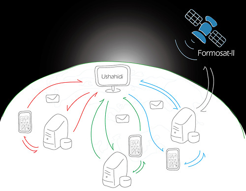
Slayer aka Kuo-Yu Chuang gave an Ignite talk on his vision for using satellite imagery and open source technology (including Ushahidi) to connect Taiwanese citizens for emergency preparedness. More details from the GeoThings Team.
Bushfire Connect closes
Maurits Vander Vlugt and the Bushfire Connect Team announced that Bushfire Connect has come to an end. Spatial Information in the 21st Century: The Rise and Fall of @BushfireConnect (http://spatial21.blogspot.com/2012/10/the-rise-and-fall-of-bushfire-connect.html?spref=tw … ). The lessons learned are key to understanding the long tail project needs to sustain resources and funding. I would encourage people to review this piece as they plan their work and also to consult the 3rd Ushahidi Toolkits about Outputs of a project. Lastly, I wish all the team members well and can't wait to see what they work on next.
Deployment of the Week:
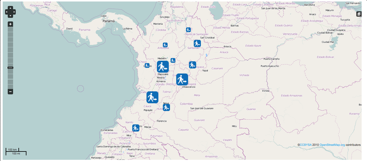
Congratulations to Il Simulacro Nacional y IV Simulacro Distrial de Evacuacion por Sismos - Deployment of the Week. See all the Deployments of the Week.
Using Ushahidi should only be one component of our outreach campaign for preparedness. The Colombia Simulation project truly focused on the citizen engagement. Check out this video on how to plan:
Code:
About: What code are your working on? What needs help?
The Next Community Developer Call is Monday, October 22nd. See Developer Community Meetings for all the times and how to connect. We'll be talking about Ushahidi v3. Check out the following wiki pages about the DB schema and more. (Ushahidi Platform v3.x)
The RHOK ICCM challenges included three Ushahidi related hacks among the 7 amazing projects:
1. OpenIR from MIT continued to build on their Ushahidi plugin.
2. A subtle but powerful glue was created by Josh Snider while working on Challenge 15: Extracting info into SMS reports. A user could send in a text which would port directly into a wiki and geocode. If formatted incorrectly, a text is returned to the person asking them to reformat. The potential of messaging format issues could assist in the accuracy of content collected to so support digital humanitarians in processing massive amounts of incoming texts into maps.
3. Dale Zak of the Ushahidi team worked with participants to improve Ushahidi search by location and topic. Here is a protomap (also available for download): 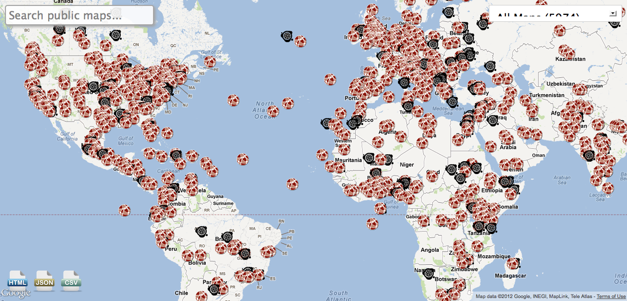
Events:
About: Events, presentations and hosting by Ushahidi Core, Community. Share your presentations, your videos etc.
Want to learn more and discuss about mapping and information for humanitarian action? Register to the GeOnG, the 3rd Forum of Geographic Information for Relief & Development, on November 5 & 6th in Chambéry, France (1h20 from Geneva)! Deadline is October 21st.
UN Spider did a write up about ICCM: The 4th International Conference of Crisis Mappers (ICCM) took place from 11 to 14 October 2012 in Washington D.C. bringing together experts, practitioners, policymakers, technologists, researchers, journalists, scholars, hackers and skilled volunteers engaged at the intersection between humanitarian crises, technology, crowdsourcing, and crisis mapping.